The US Global Change Research Program has just released the 2014 National Climate Assessment. You can download the entire document or explore the information online.
To see what they have to say about the Northeastern US, check out these links:
- Online Summary: http://www.globalchange.gov/explore/northeast
- Chapter Online: http://nca2014.globalchange.gov/report/regions/northeast
Observed Climate Change
Between 1895 and 2011, temperatures in the Northeast increased by almost 2˚F (0.16˚F per decade), and precipitation increased by approximately five inches, or more than 10% (0.4 inches per decade). Coastal flooding has increased due to a rise in sea level of approximately 1 foot since 1900. This rate of sea level rise exceeds the global average of approximately 8 inches (see Ch. 2: Our Changing Climate, Key Message 10; Ch. 25: Coasts), due primarily to land subsidence, although recent research suggests that changes in ocean circulation in the North Atlantic – specifically, a weakening of the Gulf Stream – may also play a role.
The Northeast has experienced a greater recent increase in extreme precipitation than any other region in the United States; between 1958 and 2010, the Northeast saw more than a 70% increase in the amount of precipitation falling in very heavy events (defined as the heaviest 1% of all daily events) (see Ch. 2: Our Changing Climate, Figure 2.18).
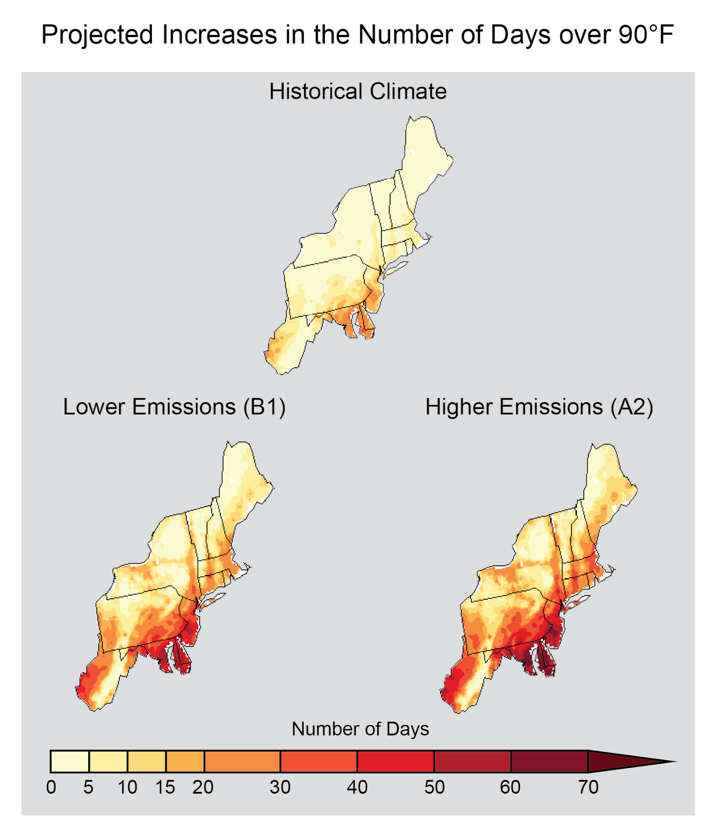 |
Projected increase in the number of days per year with a maximum temperature greater than 90°F averaged between 2041 and 2070, compared to 1971-2000, assuming continued increases in global emissions (A2) and substantial reductions in future emissions (B1). (Figure source: NOAA NCDC / CICS-NC). |
