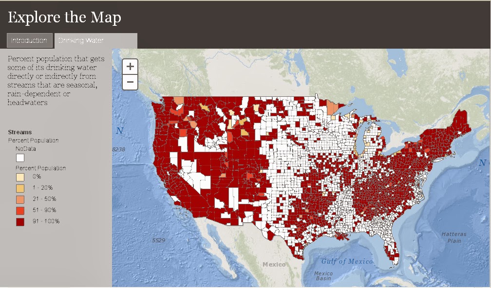
EPA has used the National Hydrography Dataset to create a county-by-county map of the percent of the population that receives at least some of its drinking water from streams that are seasonal, rain-dependent or headwaters. It’s easy to tell upon first glance just how incredibly important these streams are for drinking water across the nation. Clicking on a specific county can tell the local story. This is where we get to the number: at least 117 million Americans get drinking water from these streams.
For more information, visit the EPA Connect blog
View the Interactive MAP
________________________________
Source: EPA Water Headlines
